.png?w=auto&h=400)

Pangarchulla Peak Trek Overview
Quick Facts of Pangarchulla Peak Trek

Maximum altitude - Pangarchula summit is 14700 feet (4500 metres)
Grade - Moderate to Difficult.
Duration - 6 Days
Trekking distance - 44 kms
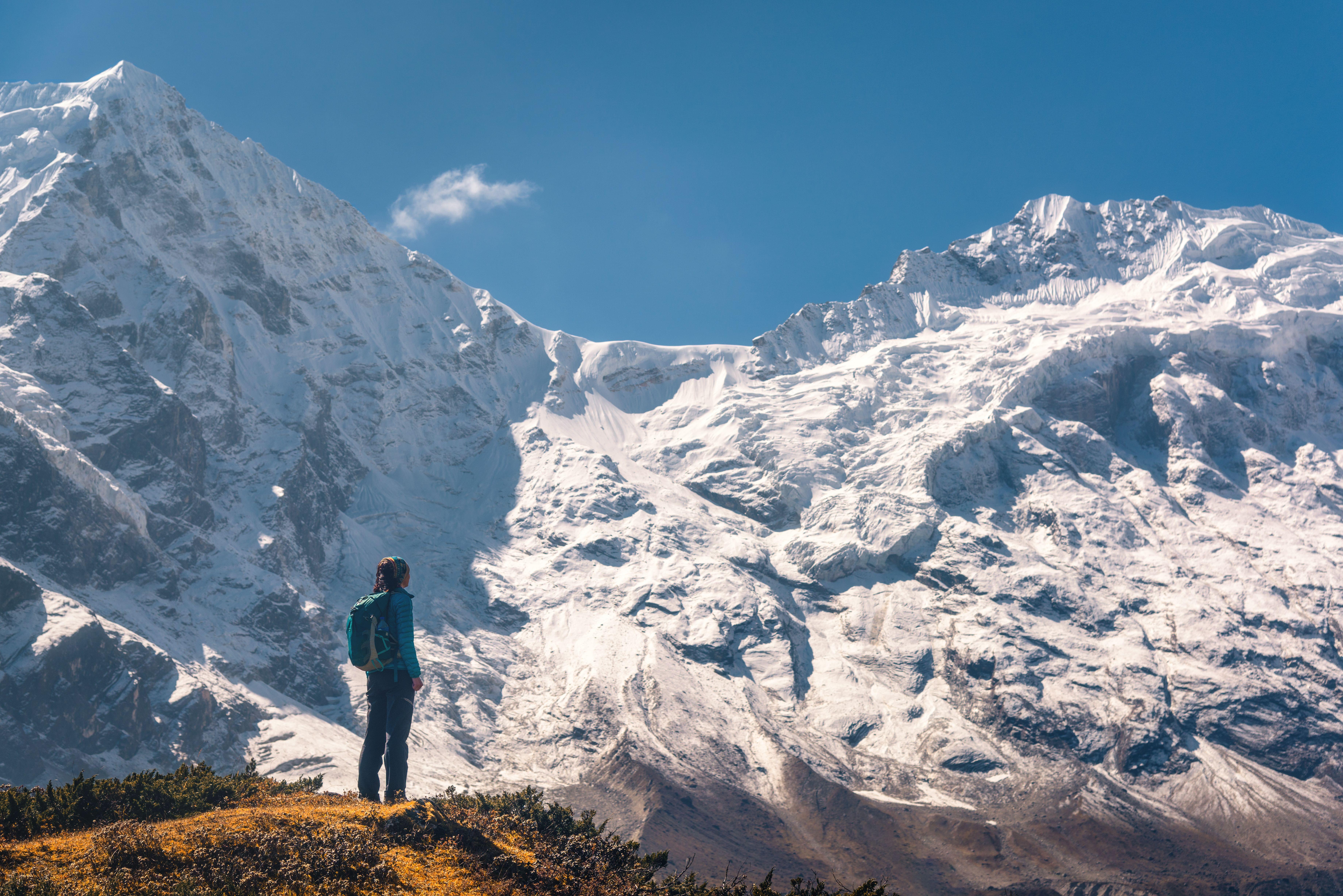
Trail type - The summit offers 360-degree views of Himalayan peaks such as Mt. Nanda Devi, Hathi Parvat, Ghodi Parvat, Kamet, and Dronagiri.
Rail head - Rishikesh Railway Station
Airport - The closest airport to Haridwar is Jolly Grant Airport in Dehradun. From Mumbai or Delhi, travellers can fly directly to Dehradun, or they can take a connecting flight from any location in India. You may hire local automobiles outside of the airport to go from Dehradun to Haridwar via road.
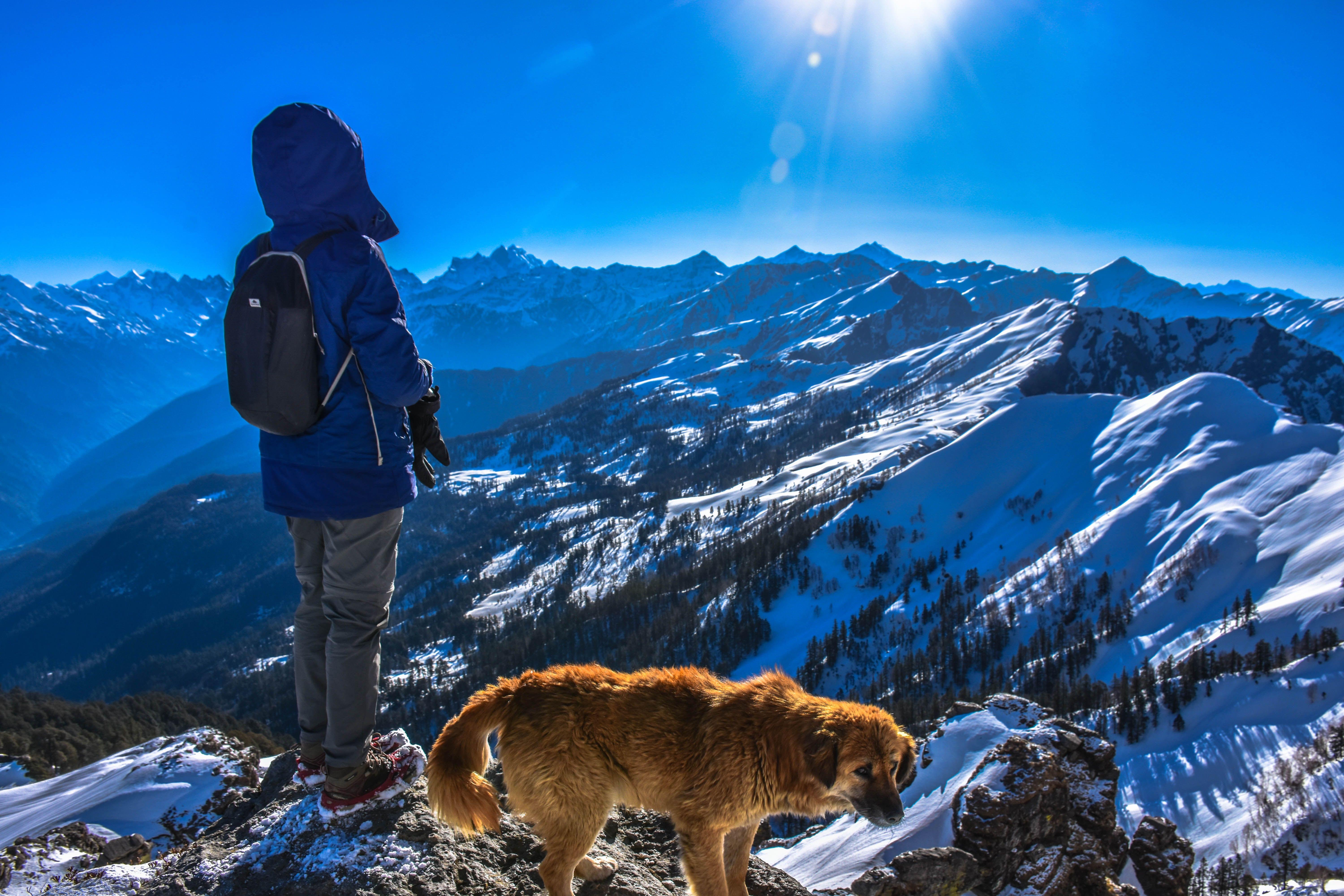
Snow Season - Temperature will be around 18°C to 12°C during the day time and in the night -3°C to -6°C
Service from - You may take a bus or a cab from Haridwar to Joshimath. Transportation will be available at an additional fee.
Best season - The optimum period for a Pangarchulla hike is between March and April, when the path is covered in ice and snow and between October and November.
Who can participate: The Pangarchulla peak trek is suitable for experienced trekkers and those who have already completed moderate level climbs. If you are a novice who is serious about training, you will require a minimum 2-3 months to get prepared physically and psychologically for Pangarchulla.
Short Itinerary for Pangarchulla Peak Trek
Pangarchulla Peak Trek Detailed Itinerary

Haridwar to Joshimath
- Altitude - 6,750 ft
- Drive: 256 km
Duration - approx 9 hours
Trekkers will be collected at Haridwar at 6:30 a.m. in either a Tata Sumo or a comparable vehicle (cost not included). Arrive in Joshimath about 5 p.m. where you can have tea, briefing of the trek & dinner.
On the road, breakfast and lunch (exclusive of charges)The guest house will provide you with lodging.

Joshimath to Gulling
- Trek Distance: 6 km,
- Camp elevation: 9,650 ft.
- Time required: around 6 hours
Trek Grade - Moderate
Begin your morning with a delicious breakfast and then travel 10 kilometers to the place where you may begin trekking to Guling.
Climb down to reach another thicket of Oak, Chestnut, Deodar, and Maple trees.
Continue going on the route and you will see the magnificent Dronagiri mountain, that will also make your heart skip a beat, and subsequently we will arrive at Gulling top, our destination for the day.
Set up camp in tents here and relax for the night.

Guling to Kuari Pass
- Altitude - 11,100 ft
- Trek Distance - 12 Km
- Elevation: 11,070 ft Time spent: around 10 hours
Trek gradient: Moderate
Begin with an early breakfast before beginning your Kuari pass hike, which will take you up fields painted in various shades of green and populated with herdsmen and their sheep grazing.
Continue climbing for yet another three hours to get Kuari Pass.
After that, descend to the base camp of Pangarchulla mountain, from which you can see Chaukhamba, Kedarnath, Neelkanth, Haathi-Ghodi, Kamet, Mana, and Dronagiri.
Set a tent in the lower khullara camp at the base camp.

Lower Khullara (11,100 ft) to Pangarchulla top (15069 ft)
Trek distance - 12 km
Altitude - 15,069 ft
Grade - Moderate to difficult
Return to lower Khullara
Start your day off early, around 5:00 AM, with a filling meal, and then set out on your walk by climbing mountain slopes until you reach a ridge that will take you to the peak.
The Mt. Nanda Devi, Trishul, and Changabhang peaks are a visual treat along this path to the Pangarchulla peak trek.
Before continuing your descent to the camp, take some time to bask in the wonders.

Lower Khullara (11,100 ft) to Auli (8600 ft) through Gurson Bugyal
Trek Duration - 5 to 6 hours
Trekking Distance - 10 kilometers
Drive Duration - with 45 minutes to drive to Joshimath.
Altitude - 11000 feet
After a hearty breakfast, set off on a hike in the direction of the route connecting Joshimath and the Niti-Malari valley.
Hike through thorny bushes and quaint towns together all the way to Gurson Bugyal. To understand more about the residents and their traditional culture, you may even stop by the towns of Tugasi and Kharsi.
Drive to Joshimath, where your lodging is waiting for you with a hot lunch and a hot shower. You are welcome to live here.

Joshimath - Haridwar Drive
After breakfast, depart from the Pangarchulla Peak Trek across the icy surroundings and drive down to Haridwar.
Mother Nature and her magnificence in your spirit and mind which has inspired you during the entire voyage, are the only things that will remain constant along the journey.
Continue to your destination to complete this thrilling Pangarchulla Peak hike through Kuari Pass.
Note: The Pangarchulla mountain climb and a trip to the genuine Kuari pass are both included in our 6-day programme. However, in addition to the amount of snow and the weather, it also depends on how well the team performs.
What to Pack for Pangarchulla Peak Trek?

- Head torch
- Winter Jacket
- Caps
- Toilet paper & wipes
- Walking stick
- Back pack (50-60l)
- Water bottle
- Binoculars
- Fleece jackets and thermals
- Hiking shoes
- Mosquito & insect repellent
- Thermal inners
- Waterproof windcheater
- Woolen cap, socks, mittens & scarf

Pangarchulla needs robust hiking boots with adequate traction, ankle support, and snow-handling capabilities.
A 50 to 60 litre backpack is required for a hike like Pangarchulla. Ensure your backpack has strong shoulder and hip supports as well as quick-access compartments.
In the mountains, it's important to layer your clothing. You are best protected from the cold by wearing layers.
Carry two t-shirts and wear one. Keep full-sleeve dry-fit T-shirts on hand (preferably collared). These protect your arms & neck from becoming sunburnt. Throughout the walk, especially at high altitudes, in the rarified air
You will require 1 set of inner thermals, a padded jacket, a few light fleece layers, and 1 light sweater. Don't buy your grandmother's knit sweaters since they can be exceedingly hefty. Sweaters and fleece coats are necessary.
For this journey, two pairs of trekking pants should be plenty. Carry one pair if it rains and wear one pair. Trekking is a great time to wear pants featuring zipper cut-offs at the thighs.
Snow blindness may be avoided using sunglasses. Through a hike like Pangarchulla, you may anticipate walking on extensive snowy terrain and snow blindness can result from exposure to bright sunlight reflected through snow.
A sun hat is required. Without a sun cover, hiking can result in headaches, sunburns, rapid dehydration, and a significant decline in hiking performance.
You need the mittens to keep you warm on a trek like Pangarchulla. Purchase synthetic hand gloves with an inside cushioned lining and an outside waterproofing.

The forest department needs these records for legal reasons. You won't be able to hike without any of these.
- Original and photocopy of a government identity card
- Disclaimer Certificate
- Medical Certificate
Know Before You Go to Pangarchulla Peak Trek

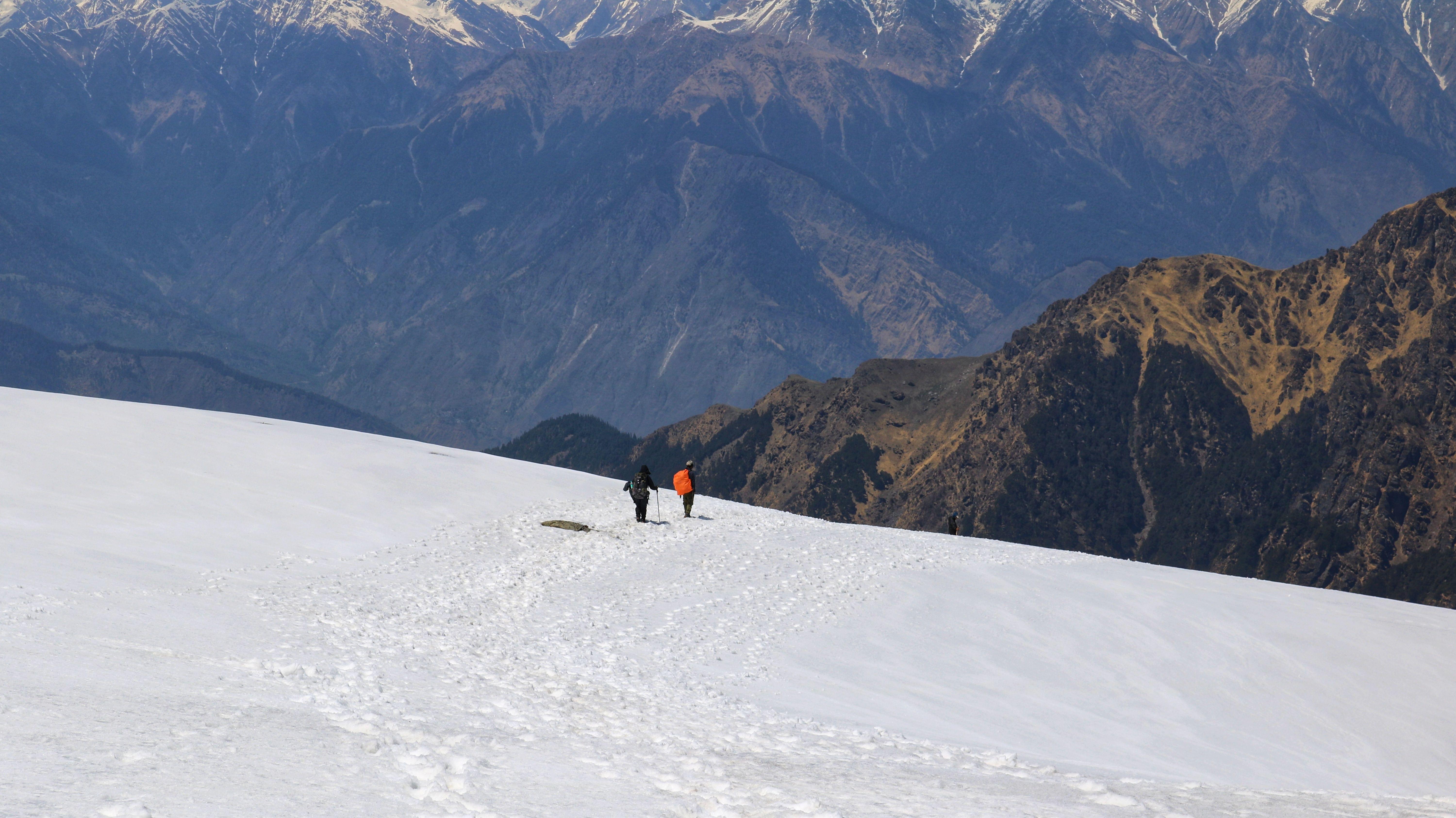
One of the greatest Himalayan summit treks one may take in April is to Pangarchulla Peak. Technically speaking, the 14,700-foot summit is not a behemoth. A careless attitude, though, can lose you the well-deserved summit glory. Take into consideration the tips and suggestions to increase your possibility of attending the Summit.
Trekkers must always have a photocopy of their picture ID with them while entering the forest checkpoints.
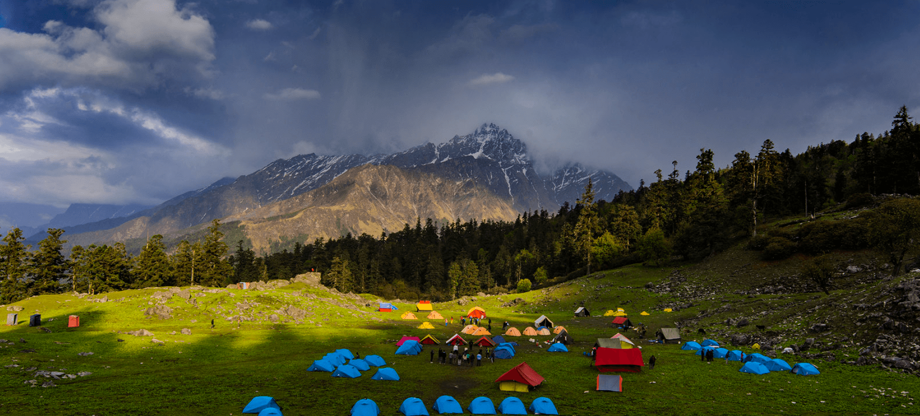
Your lodging will be organized in lodges at the base camp.
You will spend three nights in a tent while on the hike.
At the base camp, we provide a cloakroom for extra luggage. Keep your valuables out of the cloakroom.
Please be aware that twin-sharing tents might not be offered. This is due to the fact that various nations supply the basic materials used to make tents.
However, because of the upheaval across the world, their export has suffered. Tents are now in limited supply everywhere as a result.
Despite this, you will still have plenty of room as these tents are made to fit three hikers.
Check the snow conditions with your guide and time your trk=ek according to the fall of snow.
Carry all the trek gears you will need to carry as there might be a time when the ponies won’t be available.
Make an early start to the day and plan your summit according to the proper time as it takes 7 hours to reach.

Driving from Joshimath to Rishikesh
Drive: 254 kilometers
Drive 10-12 hours through Joshimath to Tugasi via car.
From Tugasi, hike to Gulling or Akhrot GhettaTrekking distance: 12 kilometers Altitude Gain: 8,790 to 10,908 feet during a period of 6-7 hours
Trek to Khullara from Gulling or AkhrotghettaTrekking distance of 6 km, time required for the trek, and elevation gain of 10,908 to 11,010 feet
Khullara's Acclimatization Day. Trek back to Khullara after visiting Kuari Top7 km, 4-5 hours, with an elevation gain and loss of 11,010 feet to 12,600 feet before returning to 11,010 feet.
Trek to Pangarchulla Summit from Khullara and then return.Trekking across 12 kilometers for 10 to 12 hours with an elevation gain and loss of 11,010 feet to 15,069 feet before returning to 11,010 feet.
From Khullara, hike to Karchi, then take a car to Tapoban and head back via Tapoban to Rishikesh Driving Range: 260 km | Hike Duration: 10–11 hours Altitude Loss: 11,010 feet to 7,315 feet Trek Length: 5.25 km | Traveling Duration: 3–4 hours
Depending on the weather and the path you follow, the length between campsites might change by 100 meters. For identical reasons, the altitude may likewise change by 100 feet.

By Air: The closest airport to Haridwar is Jolly Grant Airport in Dehradun. From Mumbai or Delhi, travelers can fly directly to Dehradun, or they can take a connecting flight from any location in India. You may hire local automobiles just outside of the airport to go from Dehradun to Haridwar via road.
By Rail: Arriving at Haridwar By Train: There are regular trains from Delhi to Haridwar Railway Station in 4-5 hours & Dehradun (1 hour). Additionally, a few trains run to Rishikesh each day.
By Road: Since there are good bus connections from all major towns and cities to Haridwar, travelers may go there as comfortably and at their leisure. The distance between Chandigarh and Delhi is 205 kilometers.

Only April offers access to the Pangarchulla Peak trip which is the spring season. The other seasons are not favorable for the trek hence it remains closed. As the route contains too much snow before April, the summit ascent is not feasible.
Following April, the snow fades away, making the summit climb hazardous due to exposed stones. These stones are large and have several gaps among them, making it difficult for any hiker to pass between them. It is quite hazardous as well as quickly exhausted. Due to these factors, it is recommended to make the ascent before the snow melts. The mountaintop climb is best accomplished during this brief window, even though the remainder of the path is accessible for approximately 8 months out of the year.
On the Pangarchulla trek in April, it is officially Spring. At this moment, lovely meadows are emerging as the snow begins to melt. Although there is little snow in the campgrounds, there is a lot of newly fallen, heavy snow over 12,000 feet. This is the ideal quantity of snow needed to make it easier to reach the top. Concluding that spring provides a best of both worlds where the ideal timeframe for mountain ascents and the season to view new blossoms. The journey is only accessible and secure during this period.
General Trivia About Pangarchulla Trek

The origin of the word Pangarchulla is a fascinating tale. The direct translation of this name, Pangarchulla, describes how it seems to be a chimney surrounded by maple trees. Chulla signifies a chimney, and Pangar means "maple," which alludes to maple trees.
A flower called Saussurea Obvallata, also known as Brahma Kamal, grows in the Himalayan alpine meadows over 14,000 feet. On the reverse side, you will see wide meadows covered in Brahma Kamal flowers, about 1,000 feet below Pangarchulla Peak. Many locals climb Pangarchulla "barefoot," go through the meadows to gather these flowers, and then present them to their God. In many areas of Himalayan region, putting these flowers on one's person is a customary practice.
Tali Lake is situated exactly where high elevation meadows begin, at the ending of the treeline. It's breathtaking to see Mount Nanda Devi, Mount Dronagiri, as well as other mountains reflected in the lake.
The campground in Akhrot Ghetto is situated beneath a massive, ancient walnut tree. It derives its name from that. Akhrot is Arabic for walnut. You may see peaks including Hathi Parvat, Gauri Parvat, Mt. Barmal, Mt. Dunagiri, and Garud Parvat, among others, in awe-inspiring detail from this location.
Why to Go for Pangarchulla Peak Trek
You May Also Book
FAQ's of Pangarchulla Peak Trek
What is the height of Pangarchulla Peak?
The height of Pangarchulla peak is 4575 meters.
How Difficult is the Pangarchulla Peak Trek?
The Pangarchulla Peak hike is classified as a challenging level 1 trek with - Difficult, steep routes - Ascends to approximately 15,000 feet - Trekking hours can exceed 9 hours per day - Few exit alternatives- Prior high elevation trek experience and excellent cardiovascular fitness are essential.
We believe that perhaps the Pangarchulla Peak trip meets all of these requirements. The hike reaches an elevation of 15,070 feet. The summit day might last up to twelve hours of arduous trekking up and down 4,000 feet in one day. The summit ascent is difficult, with steep, uneven, and exposed areas.The final four hour of the summit ascent are spent hiking on firm snow over boulders. It's really difficult, demanding, and full of hard spots. It necessitates being sure-footed, always vigilant, and bearing a lot of energy.
Aside from the initial 2 days, the remaining journey is distinguished by lengthy days, with a minimum of eight hours of trekking each day.All of this adds to the difficulty of the trip. This journey is very hard to complete without previous high altitude trek expertise and adequate physical preparation.
How many days does Pangarchulla trek take?
The number of days to complete Pangarchulla Trek depends on the guide that you take. Approximately it takes about 6 days to complete.
What are the nearest airports and railway stations for Pangarchulla Trek?
The nearest airport is the Jolly Grant airport while the nearest railway station is Rishikesh railway station.
Is offloading available on Pangarchulla Trek?
Keeping in mind the footprints that are left behind by porters and mules, it is best to not opt offloading but if there is any medical issue with someone, offloading is available for them with an additional cost.
What is the nearest ATM at Pangarchulla Peak Trek?
Joshimath is the last place where you will find ATMs but the chances of cash getting exhausted at Joshimath ATMs are high. Hence, it is recommended that you withdraw cash from Rishikesh itself.
Treks in Himachal
Treks in Uttarakhand
Treks in Nepal
Treks in Kashmir